DAVIO

Dense monocular–inertial SLAM with feed-forward initialization and pose-conditioned mapping: one camera, one IMU, and a metric dense map built while you walk.

Code Explore the maps Paper — soon

ORI r01, a building interior. Top left, the camera; around it, the map DAVIO builds from those frames — all four views show the same moment.

Interactive

The maps, interactive

Each is the run's own fused output, thinned for the browser. Drag to orbit, scroll to zoom, right-drag to pan. The tube is the trajectory, blue at the start to red at the end.

—
drag · scroll · right-drag
loading…

EuRoC is a monochrome dataset, so its map is grey — that is the sensor, not the method. The phone walk was recorded with no calibration at all.

Your own data

It runs on a phone, uncalibrated.

212 seconds along a beach promenade, recorded with a phone held in portrait: intrinsics from the lens spec, no camera–IMU calibration, placeholder IMU noise.

  • DAVIO's initializer and OpenVINS's online calibration recover the focal length and a 15 ms camera–IMU time offset while it runs.
  • 186 m walked with no jumps, and under a metre of height drift.
  • Sky gets a finite depth from the network; two settings keep it out of the map.

Method

Depth Anything 3 at both ends of an unmodified filter
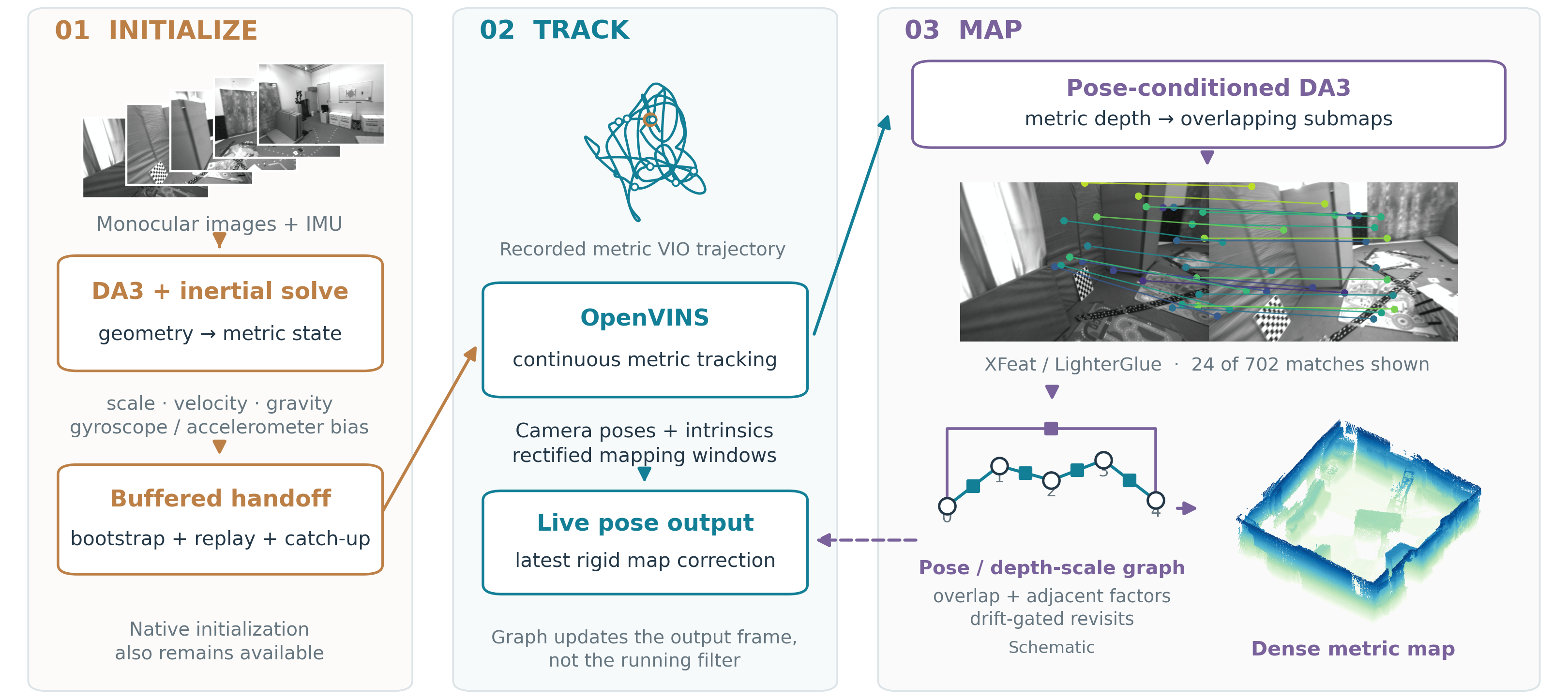
DAVIO pipeline: feed-forward initialization, unmodified OpenVINS tracking, asynchronous pose-conditioned dense mapping with a submap graph

Citation

@inproceedings{davio,
  title     = {DAVIO: Dense Monocular--Inertial SLAM with Feed-Forward
               Initialization and Pose-Conditioned Mapping},
  year      = {2026}
}